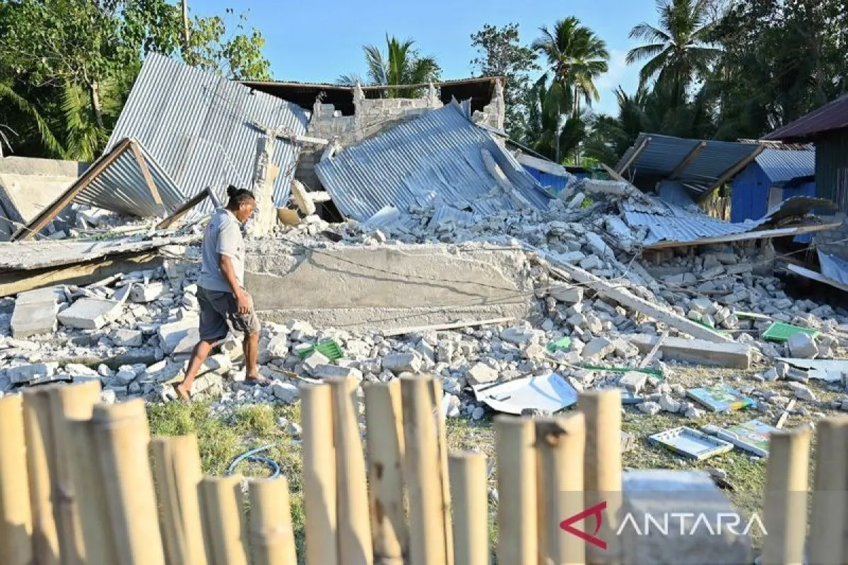
A shallow offshore earthquake struck southwest of Kodi in Southwest Sumba, East Nusa Tenggara, on 4 October 2026. BMKG’s initial event card listed magnitude 6.1, 10 km depth and a location 14 km southwest of Kodi; BMKG later updated its analysis to magnitude 5.9, 30 km depth and 59 km southwest of Kodi, and said its tsunami model showed no tsunami…
BNPB REPORTS 1 LIGHT INJURY AND NO DEATHS; SEPARATE POLICE REPORTS 1 FATALITY FROM SHOCK · DAMAGE ASSESSMENT CONTINUES
Heavy rain triggered flooding in Toribulu district, Parigi Moutong, Central Sulawesi, on 27 September 2026. Indonesia’s National Disaster Management Agency (BNPB) said a rapid assessment recorded 160 houses and three public facilities affected in Toribulu Selatan, Tomoli Utara, Sibalago and Singura. BNPB reported that floodwater had receded by its 28…
160 HOUSES AND 3 PUBLIC FACILITIES AFFECTED · FLOODWATER REPORTED RECEDED
A flash flood struck villages in Kota Agung Barat and Sumberejo districts of Tanggamus regency, Lampung, at about 02:00 WIB on 22 September 2026. Indonesia’s National Disaster Management Agency (BNPB) reported 150 households affected. The BNPB assessment recorded 53 houses, two education facilities, three places of worship, 50 hectares of plantation…
150 HOUSEHOLDS AFFECTED · 53 HOUSES AND 1 BRIDGE AFFECTED · WATER RECEDED
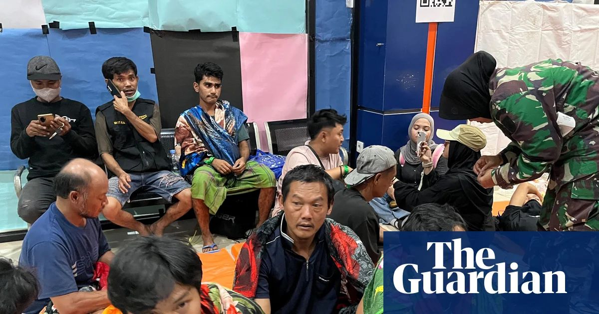
Indonesia's National Search and Rescue Agency (Basarnas) is continuing the search inside and around the capsized KM Virgo Transport 8 in the Java Sea. The 21 September operational observation was 108 survivors, 15 confirmed deaths and 120 people still missing from the working 243-person manifest. The latest Basarnas reconciliation, reported on 28…
A flood in Nagari Simpang Tonang, Dua Koto district, Pasaman regency, West Sumatra, left one person dead after the person initially reported missing was recovered. The final national-authority entry records one death and no one remaining missing. The flood began on 18 September 2026 after heavy rain caused the Aek Koronok and Batang Jember Tonang Raya…
1 CONFIRMED DEATH · 0 REMAINING MISSING · FLOODWATERS RECEDED
A sustained eruption of Anak Krakatau in Indonesia's Sunda Strait sent volcanic ash across parts of Java and Sumatra, disrupting aviation and prompting authorities to maintain heightened monitoring. Indonesia's Geological Agency said the continuous eruptive episode lasted about 25 hours, from late on 4 September until shortly after midnight on 6…
GDACS ORANGE · ALERT LEVEL III · MONITORING ONGOING
A magnitude 7.7 earthquake struck offshore, about 30 kilometres northeast of Mbay in Indonesia's East Nusa Tenggara Province, on 15 August. BMKG located the epicentre at 8.41°S, 121.39°E and a depth of 15 kilometres. A tsunami warning was lifted later that morning after small waves were observed. By 24 August, national response reporting cited 100…
142 DISASTER-LINKED DEATHS · 46,461 DISPLACED · 103,427 HOMES UNDER RE-VERIFICATION · 15 SEP
A flash flood struck Nagari Batang Barus in Gunung Talang district, Solok Regency, West Sumatra, on the evening of 21 September 2026 after intense rainfall. BNPB’s 26 September update confirms two deaths, four injured people and about 480 people displaced; the search and rescue operation ended after all people reported missing had been located. This is…
SAR CLOSED · 2 DEAD · 4 INJURED · ABOUT 480 DISPLACED
Three fishers disappeared after leaving by speedboat at about 05:30 WIT on 19 September 2026 to check fishing nets around Muara Kali Mooi, Waan district, Merauke regency, South Papua. The initial report named Frederikus Yolmen, Andreas Koboon and Abelbertus Game Yolmen as missing and prompted a joint search by Basarnas Merauke, police, military personnel…
2 CONFIRMED DEATHS · 1 PERSON STILL MISSING · ACTIVE SEARCH CLOSED
An earthquake of 4.8M at a depth of 10 km occurred on Bali Island (Indonesia) on 15 October at 20.18 UTC (16 October at 4.18 local time). The epicentre was located in the Karangasem Regency (the easternmost Regency of Bali) in a mountainous area close to the Agung Volcano. The Indonesian National Board for Disaster Man
Four people have lost their lives after landslides and floods struck in South Sulawesi Province of Indonesia. Meanwhile heavy rain has caused flooding and landslides across parts of Kalimantan, Borneo Island, forcing hundreds of people to flee their homes. South Sulawesi Province Heavy rains triggered the overflow of t
Tropical Cyclone SEROJA continues moving south-west over the Indian Ocean, and on 8 April at 0.00 UTC, its centre was located approximately 580 km north-west of Karratha City (coastal Pilbara Region, Western Australia), with maximum sustained winds of 102 km/h. Meanwhile, the impact across eastern Indonesia and Timor-Leste has increased after the passage…
Comments:On 29 March - 1 April, several flooding and landslide events, triggered by heavy rainfall, occurred mostly in Java, Sumatra, and western Lesser Sunda Islands, resulting in about 75,506 affected people, and at least 50 displaced residents.
Flooding has affected over 90,000 people in Semarang City, Central Java, Indonesia over the last few days. One person died after flood waters caused parts of a wall to collapse. Heavy rain triggered landslides in Samarang City, Indonesia, Late February 2021, with emergency workers carrying out rescues. Photo: BPBD Semarang City Flooding began on 23…
The Smithsonian/USGS Weekly Volcanic Activity Report provides information about global volcanism on a weekly basis. Latest Merapi report has been published on 27 Jan 2021 07:39. BPPTKG reported that the ?2021 lava dome? continued to grow just below Merapi?s SW rim during 15-21 January, producing a total of 282 incandescent lava avalanches that traveled…
Indonesia’s Meteorological, Climatological, and Geophysical Agency predicts the peak of La Nina to occur in December 2020 and January 2021. The peak of La Nina coincides with the peak of rainy season which usually occurs between January and February. The agency also states that this phenomenon could increase precipitation which triggers heavy rainfall…
A strong earthquake of 6.2 M hit the Western part of Sulawesi on the early morning of 15 of January. The epicenter of the quake was six km northeast of the city of Majene, at a depth of 10 km. The situation is still developing with possible aftershocks that could also trigger tsunami warnings. According to IFRC, the earthquake did not trigger a tsunami…
Chronology: Caused by high-intensity rainfall which resulted in the broken of the Kanana embankment at Kali Suntang on Friday, 1 Jan 2021, at 02.00 WIB Casualty: • 587 families / 1,651 people affected Material loss: • 587 housing units damaged • 155 Ha of rice fields Latest Condition: As of Friday, 1 Jan 2020, at 09:53 WIB, the flood still inundated. The…
On Sunday, 29 November 2020 at 13.00 hours, Central Indonesia Time (GMT+8), Indonesia’s Centre for Vulcanology and Geological Disaster Mitigation (Pusat Vulkanologi dan Mitigasi Bencana Geologi – PVMBG) raised the alert level from Level 2 (advisory) to Level 3 (watch/alert) after increasing activity of Ili Lewotolok Volcano (also known as Ile Lewotolo).…
Floods and landslides have affected wide areas of Indonesia since 07 October, 2020. At least 3 people have lost their lives. Homes have been damaged or destroyed and hundreds of people displaced. Java Island West Java Flooding since 11 October 2020 has affected around 1,000 households in 6 districts of Garut Regency in West Java Province. The affected…

 Indonesia