
Post-tropical Isaias brings flash-flood risk across the Southeast
Tropical Cyclone A
How the score is calculated
The score starts at 8. It adds points from recorded affected, deaths, displaced and casualty counts, plus terms found in the story title, event type or status. For each count, only its highest matching band is used.
- Affected people
- 1–999: +5 · 1,000–9,999: +12 · 10,000–99,999: +20 · 100,000–999,999: +28 · 1 million+: +35
- Deaths
- 1–9: +8 · 10–99: +14 · 100–999: +22 · 1,000+: +30
- Displaced people
- 1–9,999: +6 · 10,000–99,999: +12 · 100,000+: +18
- Casualties
- 100 or more: +8
- Story wording
- +10 for terms such as catastrophe, famine, war, conflict, major earthquake, mass casualty or critical. Otherwise, +5 for active, ongoing, emergency, outbreak, cyclone or hurricane.
Score bands: Watch 0–24 · Moderate 25–49 · High 50–74 · Critical 75–100. Scores are capped at 100. Missing or unparseable figures add no points.
This is a rule-based WorldsAid triage indicator, not an official or independently validated classification. It does not account for recency or local context, and it can understate events with incomplete reporting. Check the linked sources.
In brief
- What happenedPost-tropical Cyclone Isaias was northeast of Nashville at 15:00 UTC on 11 October 2026, about 285 km from the city.
- Reported impactLatest advisory: Post-tropical cyclone · WPC final public advisory 20 · 15:00 UTC, 11 October 2026 · Latest reported position: 37.5°N, 84.0°W · about 285 km northeast of Nashville · moving east-northeast at 35 km/h · 1010 mb · 11 October, 15:00 UTC · Maximum sustained winds: 35 km/h · WPC advisory 20 · 11 October 2026, 15:00 UTC
- What help is neededResponse priorities should be confirmed in the linked source reports as needs change.
What changed
Updated verified snapshot
This record was first dated 2026-10-07 and last verified 2026-10-11T15:00:00Z.
Situation
Post-tropical Cyclone Isaias was northeast of Nashville at 15:00 UTC on 11 October 2026, about 285 km from the city. In its final public advisory, the Weather Prediction Center (WPC) reported maximum sustained winds of 35 km/h and minimum central pressure of 1010 mb. Isaias was moving east-northeast at 35 km/h. Flood watches remained in effect for portions of the Central and Southern Appalachians, with a wind advisory for portions of the Central Appalachians.
WPC said the flash-flood threat was decreasing, though localized flash and urban flooding remained possible across the Central Appalachians into the Mid-Atlantic on 11 October. Rapid river rises and flooding remained possible in western North Carolina as rainfall diminished. A couple of tornadoes were possible across the Piedmont and Coastal Plain of Virginia and North Carolina. These were forecast hazards, not confirmed impact totals. WPC forecast the low would dissipate later that day; this advisory did not confirm dissipation. People should follow current local weather and emergency-management guidance rather than treat these dated warnings as current.
WorldsAid verification
A WorldsAid editor reviewed this record against 22 attributed sources, cleaned feed formatting and checked the crisis, place and reporting date. 9 human-impact figures were separated from the narrative and dated where the source allowed. Earlier observations remain in the evidence history instead of being silently overwritten.
Verified figures
- Latest advisory
- Post-tropical cyclone · WPC final public advisory 20 · 15:00 UTC, 11 October 2026 retained at 2026-10-11T15:00:00Z
- Latest reported position
- 37.5°N, 84.0°W · about 285 km northeast of Nashville · moving east-northeast at 35 km/h · 1010 mb · 11 October, 15:00 UTC retained at 2026-10-11T15:00:00Z
- Maximum sustained winds
- 35 km/h · WPC advisory 20 · 11 October 2026, 15:00 UTC retained at 2026-10-11T15:00:00Z
- Flood watches at advisory time
- Portions of the Central and Southern Appalachians · 11 October 2026 retained at 2026-10-11T15:00:00Z
- Flood and wind outlook
- Flash-flood threat decreasing but localized flash/urban flooding and rapid river rises possible; wind advisory in parts of the Central Appalachians · 11 October forecast retained at 2026-10-11T15:00:00Z
- Dissipation scope
- Dissipation later on 11 October was forecast, not confirmed by this advisory retained at 2026-10-11T15:00:00Z
- GDACS overall modelled exposure
- 680,000 people in Category 1-or-higher wind footprint · modelled, not confirmed affected retained at 2026-10-11T15:00:00Z
- GDACS whole-storm maxima
- 194 km/h (Category 3); 1.4 m modelled surge dated 10 October, 02:00 UTC · overall Orange retained at 2026-10-11T15:00:00Z
- Scope safeguard
- Dated observations and forecasts only; no confirmed casualty, displacement, affected-population or damage total inferred retained at 2026-10-11T15:00:00Z
What we knew when
- WorldsAid record entered the retained historical dataset.
- WPC ADVISORY 16 · POST-TROPICAL CYCLONE INLAND OVER CENTRAL ALABAMA · FLASH-FLOOD RISK CONTINUES preserved as a dated, source-linked observation. Source
- NHC ADVISORY 12 · CATEGORY 3 MAJOR HURRICANE · 195 KM/H · 959 MB · HURRICANE, STORM-SURGE AND TROPICAL-STORM WARNINGS preserved as a dated, source-linked observation. Source
- NHC CORRECTED INTERMEDIATE ADVISORY 11A · 175 KM/H HURRICANE · 958 MB · CORRECTED STORM-SURGE VALUES AND AREAS preserved as a dated, source-linked observation. Source
- NHC ADVISORY 11 · 175 KM/H HURRICANE · 963 MB · HURRICANE, STORM-SURGE AND TROPICAL-STORM WARNINGS REMAIN IN EFFECT preserved as a dated, source-linked observation. Source
- GDACS TC 1001334 EPISODE 7 · GREEN ALERT · 176 KM/H CATEGORY 2 MODELLED MAXIMUM · ABOUT 670,000 PEOPLE MODELLED IN CATEGORY 1+ WIND FOOTPRINT preserved as a dated, source-linked observation. Source
- NHC ADVISORY 10 · 165 KM/H HURRICANE · 969 MB · HURRICANE, STORM-SURGE AND TROPICAL-STORM WARNINGS REMAIN IN EFFECT preserved as a dated, source-linked observation. Source
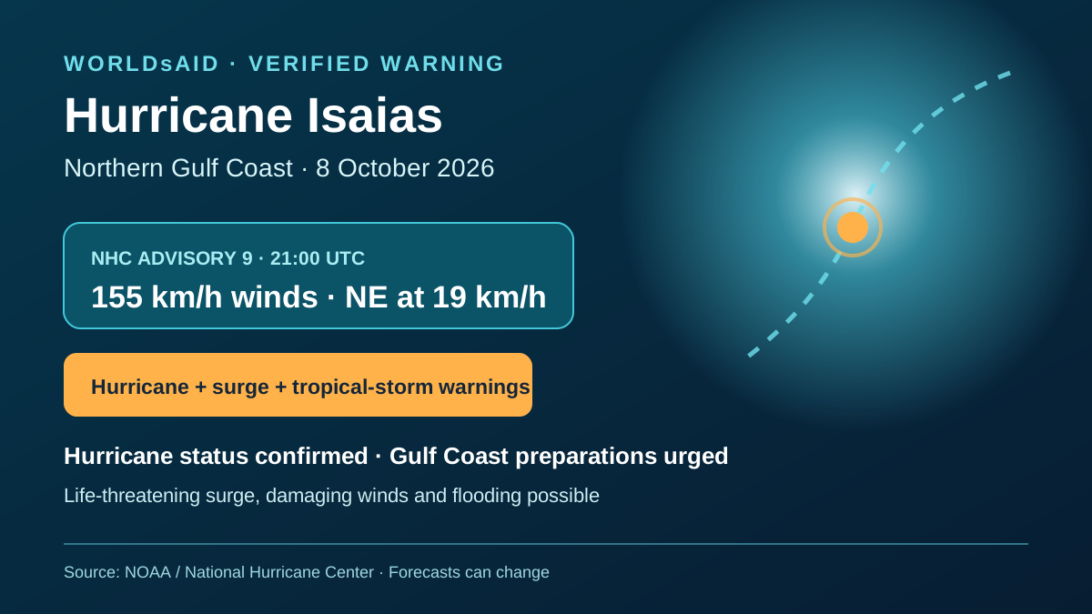
- NHC ADVISORY 9 · 155 KM/H HURRICANE · 975 MB · HURRICANE, STORM-SURGE AND TROPICAL-STORM WARNINGS REMAIN IN EFFECT preserved as a dated, source-linked observation. Source
- NHC ADVISORY 8 · 140 KM/H HURRICANE · 975 MB · HURRICANE, STORM-SURGE AND TROPICAL-STORM WARNINGS REMAIN IN EFFECT preserved as a dated, source-linked observation. Source
- GDACS TC 1001334 · GREEN ALERT · 176 KM/H MODELLED MAXIMUM · ABOUT 490,000 PEOPLE MODELLED IN CATEGORY 1+ WIND FOOTPRINT preserved as a dated, source-linked observation. Source
- NHC ADVISORY 7 · 130 KM/H HURRICANE · 979 MB · HURRICANE, STORM-SURGE AND TROPICAL-STORM WARNINGS REMAIN IN EFFECT preserved as a dated, source-linked observation. Source
- NHC TROPICAL CYCLONE UPDATE · ISAIAS BECOMES A HURRICANE · 120 KM/H · 982 MB preserved as a dated, source-linked observation. Source
- GDACS TC 1001334 · GREEN ALERT · 176 KM/H FORECAST HURRICANE MAXIMUM · ABOUT 660,000 PEOPLE MODELLED IN CATEGORY 1+ WIND FOOTPRINT preserved as a dated, source-linked observation. Source
- NHC ADVISORY 6 · 110 KM/H TROPICAL STORM · HURRICANE, STORM-SURGE AND TROPICAL-STORM WARNINGS ISSUED FOR THE NORTHERN GULF COAST preserved as a dated, source-linked observation. Source
- NHC ADVISORY 5 · 100 KM/H TROPICAL STORM · HURRICANE, STORM-SURGE AND TROPICAL-STORM WATCHES IN EFFECT FOR THE NORTHERN GULF COAST preserved as a dated, source-linked observation. Source
- NHC ADVISORY 4 · 75 KM/H TROPICAL STORM · HURRICANE AND STORM-SURGE WATCHES ISSUED FOR THE NORTHERN GULF COAST preserved as a dated, source-linked observation. Source
- GDACS TC 1001334 · GREEN ALERT · 176 KM/H FORECAST STORM MAXIMUM · ABOUT 740,000 PEOPLE MODELLED IN CATEGORY 1+ WIND FOOTPRINT preserved as a dated, source-linked observation. Source
- At 0000 UTC 10 October 2026 (700 PM CDT 9 October), NHC located Hurricane Isaias at 30.1°N, 86.6°W, about 75 km southeast of Pensacola and 155 km east-southeast of Mobile. Maximum sustained winds were 175 km/h (110 mph), movement north at 30 km/h (18 mph), minimum central pressure 967 mb. NHC said there were no changes to watches or warnings; it forecast landfall on the western Florida Panhandle within the next hour or two. preserved as a dated, source-linked observation. Source
- At 0300 UTC on 10 October, NHC reported Hurricane Isaias at 150 km/h, 982 mb, near 30.8°N 86.5°W, moving north at 31 km/h. The advisory states specified warnings had been discontinued and lists the warning areas still in effect. preserved as a dated, source-linked observation. Source
- At 0600 UTC, NHC reported Post-Tropical Cyclone Isaias near 31.5°N 86.5°W, about 130 km NNE of Pensacola and 90 km SSW of Montgomery, moving north at 31 km/h with maximum sustained winds of 100 km/h and minimum central pressure of 1000 mb. NHC discontinued the storm-surge warning west of the Santa Rosa/Okaloosa County line and the hurricane warning west of the Alabama/Florida line, and changed the warning east of the Alabama/Florida line to a tropical-storm warning. NHC forecast 4–8 inches of rainfall across southern Alabama, the Florida Panhandle and Big Bend, and southwest Georgia through the weekend, with localized higher totals possible; this is forecast hazard information, not a confirmed impact report. preserved as a dated, source-linked observation. Source
- At 0900 UTC 10 October (0400 CDT), NHC located Post-Tropical Cyclone Isaias near 32.0°N 86.5°W, about 40 km SSW of Montgomery, Alabama, moving north at 22 km/h with maximum sustained winds of 55 km/h and minimum central pressure of 1002 mb. All storm-surge and tropical-storm warnings had been discontinued; no watches or warnings remained in effect. NHC forecast 4–8 inches of rain, localized up to 15 inches, in areas through the weekend; these are forecasts, not observed impacts. preserved as a dated, source-linked observation. Source
- WPC Post-Tropical Cyclone Isaias Advisory 17: at 2100 UTC 10 October, centre 33.5°N 86.9°W, about 10 km west of Birmingham; maximum sustained winds 45 km/h, pressure 1007 mb, north-northeast movement 24 km/h. Flood Watches: portions of the Southeast United States and Southern Appalachians. High Wind Warning: portions of the Southern Appalachians. Wind Advisory: portions of the Mid-South and Southern Appalachians. Rainfall of 3–6 inches with localized 10-inch maxima is forecast in specified Southern Appalachians/Carolinas areas; 1–2 additional inches elsewhere in the Southeast into northern Florida. Flooding, landslides, tornadoes and outages remain hazards, not confirmed impact totals. preserved as a dated, source-linked observation. Source
- NHC ADVISORY 14 · EXACT HISTORICAL WARNING BOUNDARIES preserved as a dated, source-linked observation. Source
- Retained WPC Advisory17 snapshot before the final-advisory update preserved as a dated, source-linked observation. Source
- At 15:00 UTC on 11 October, WPC issued its final public advisory for post-tropical Isaias: 37.5°N, 84.0°W, 35 km/h sustained winds, 1010 mb, and east-northeast movement at 35 km/h. Flood watches covered parts of the Central and Southern Appalachians; a wind advisory covered parts of the Central Appalachians. The flash-flood threat was decreasing, not absent. Dissipation later that day remained forecast. preserved as a dated, source-linked observation. Source
- GDACS overall Orange summary for 6–11 October: 680,000 people modelled in Category 1-or-higher winds; 194 km/h whole-storm maximum; 1.4 m modelled surge dated 10 October, 02:00 UTC. preserved as a dated, source-linked observation. Source
Earlier figures are never replaced by later values; additional observations are retained as new ledger entries.
Provenance
This page renders the last verified WorldsAid cache directly in HTML. It does not treat generated summaries as primary evidence.
Cached dataset: worldsai_drup771.sql.gz
Verified
SHA-256 ae2a2188bf1eb7a6b4c7e3e60586cb5aa5992243328ba81ec64f4908b1fb5cb7- WPC final public advisory 20 · Post-Tropical Cyclone Isaias · 11 October 2026, 15:00 UTC
- WPC advisory 17 · 10 October 2026, 21:00 UTC
- US Weather Prediction Center · Post-Tropical Cyclone Isaias Public Advisory 16 · 10 October 2026, 15:00 UTC
- US Weather Prediction Center · Post-Tropical Cyclone Isaias Discussion 16 · 10 October 2026, 15:00 UTC
- US National Hurricane Center · Isaias public advisory 12 · 9 October 2026, 15:00 UTC
- US National Hurricane Center · Isaias corrected intermediate advisory 11A · 9 October 2026, 12:00 UTC
- US National Hurricane Center · Isaias public advisory 11 · 9 October 2026, 09:00 UTC
- US National Hurricane Center · Isaias public advisory 10 · 9 October 2026, 03:00 UTC
- US National Hurricane Center · Isaias public advisory 9 · 8 October 2026, 21:00 UTC
- US National Hurricane Center · Isaias public advisory 8 · 8 October 2026, 15:00 UTC
- US National Hurricane Center · Isaias public advisory 7 · 8 October 2026, 09:00 UTC
- GDACS · Overall Green Tropical Cyclone for ISAIAS-26 · episode 7 · current summary checked 9 October 2026
- GDACS · Tropical Cyclone Isaias-26 · current event summary · 8 October 2026, through 09:00 UTC
- US National Hurricane Center · Isaias tropical cyclone update · 8 October 2026, 03:30 UTC
- US National Hurricane Center · Isaias public advisory 6 · 8 October 2026, 03:00 UTC
- US National Hurricane Center · Isaias public advisory 5 · 7 October 2026, 21:00 UTC
- US National Hurricane Center · Isaias forecast advisory 4 · 7 October 2026, 15:00 UTC
- US National Hurricane Center · Isaias watch/warning advisory 4 · 7 October 2026
- US National Hurricane Center · Isaias forecast discussion 4 and key messages · 7 October 2026
- GDACS · Tropical Cyclone Isaias-26 · current episode 6 snapshot · 8 October 2026
- GDACS · Tropical Cyclone Isaias-26 · earlier episode 4 snapshot · 7 October 2026
- GDACS TC 1001334 overall summary · Orange; modelled exposure and whole-storm maxima · checked 14 October 2026